It was not the storm

that broke me or the storm
before it or the storm before it.
Ciara, Brendan, Atiyah, even
distant Ophelia or Freya.

It was not the winter storms
of 2013 – 2014 before storms
were given alphabetical names.
It was not the St Jude storm,

the London or Birmingham
tornadoes, Storm Kyrill – killer
of 11 people, the Great Storm
of 1987 or any of the storms

before I was born in 1981.
It was not the cliché of the storm
within although winds have swept
through my branches broken

my fingers swayed me that way
and this like a sapling turned me over
like a hay wheel rattled me like
a bag on a barbed wire fence.

Rain has flooded my landscape,
rising up over my pagodas and bins,
my fountain and its four nymphs,
washed away all my bridges,

receded to leave a mottle of reed,
rainbow puddles to splash wellies in,
birches surprising in their reflections
like Rimbaud illuminated in 1876.

It has cleaned and cleansed me.
My Taekwondo belt is blue and green.
I am learning O Jang I but I do not
call myself Master of the Wind

for I do not know what broke me –
childhood bullying, a neurotic father,
a defective gene or something deeper
within? But it was not the storm.

*Arthur Rimbaud wrote his Illuminations in 1876.
**O Jang means ‘Wind’ and it is the fifth pattern in WTF Taekwondo.
***I wrote this poem in the aftermath of Storm Ciara during which the Ribble broke her banks at Avenham and Miller Parks and further upriver.

Remembering Penwortham Marsh

In the Doomsday Book my home town of Penwortham is referred to as Peneverdant. It has been translated by Rev. Thornber as ‘the green hill on the water.’* The name refers to Castle Hill, which stood on Penwortham Marsh, a tidal freshwater marsh frequently flooded by the river Ribble.

The marshland developed after the Ice Age and its water levels changed with the tides and the rise and fall of sea levels. During the Bronze Age there was a wooden lake dwelling evidenced by the remains of a ‘platform some 17m by 7m in extent… formed of brushwood set amidst piles’.

It seems likely people inhabited this milder lowland location in winter and, in the summer, when there were lots of midges, moved to the uplands, following the aurochs. (There are echoes of this tradition in the people of Penwortham pasturing their cattle in Brindle, in the foothills of the Pennines, up until the 14th century, when Brindle separated from Penwortham parish).

During the marine transgressions of the second millennium BC, when the weather got colder and wetter, Castle Hill would have been part of the Ribble estuary and quite literally ‘on the water’. In the Romano-British period the sea levels fell again and have remained relatively stable until now.

The vegetation of Penwortham Marsh was likely to have consisted mainly of common saltmarsh grass (pucinellia maritima), with saltmarsh rush (juncus gerardii) and red fescue (festuca rubra), areas of reed (phragmites communis) and reedmace (typha latifolia), and perhaps water crowfoot (ranunculis aquatis), lesser spearwort (rannunculus flamula), and yellow flag iris (pseudacorus).

Breeding birds would have included redshanks, dunlins, oyster catchers, grebes, curlews, shelducks, mallards, lapwings, egrets, herons, and cranes. Over-wintering birds such as pink-footed geese, Bewick’s swans, whooper swans, widgeon, teal, knot, pintails, bar-tailed godwits, black-tailed godwits, sanderlings, and golden plover would also have been seen and their calls heard across the marshland.

This remarkable species-rich habitat remained untouched until the 16th century. Its draining began with land on the south of the marsh at Blashaw close to the medieval boundary ditch. Land north of Castle Hill was also reclaimed at this time. A survey of the Farington estates from 1570 refers to the Corn Marsh of 28 ½ acres and Little Burgess Marsh, which was fenced off with posts and rails. In the 16th century, from Howick to the foot of Castle Hill, a band of marsh was enclosed as ‘large square fields’. Finally, in the 17th century the marsh at Howick closest to the river Ribble was drained.

The newly reclaimed land was used for arable agriculture from the 16th until the 18th century. In 1725 the Corn Marsh was renamed Pasture Marsh showing it was used for grazing instead. The name Cow Gate Marsh is also suggestive of use for pasturage. Other field names include Innes Marsh, Little Marsh, Middle Marsh, New Marsh, and Long Marsh. The small strips that remained as intertidal marshland beside the Ribble were called Out Marsh and Great Marsh.**

The greatest change, in the 1880s, was the movement of the Ribble 500 yards south from its original meander at present-day Watery Lane to bend sharp west then flow in a concrete channel straight out to the estuary. This had the effect of cutting Penwortham Marsh off from Castle Hill, and from Penwortham, making it part of Preston. The marsh was then dug out to form Riversway Dockland.

There is now no sign Penwortham Marsh ever existed. Not even a street name. People who visit the docks are largely unaware they are walking on a former marshland where early Britons dwelled amongst reed, rush, waterfowl, mighty aurochs, and their gods, spirits, and ancestors.

Unlike with other intertidal marshlands beside the Ribble which, following, their draining have been rewetted, such as Hesketh Out Marsh, there is no way that Penwortham Marsh can ever be restored. Its separation from Castle Hill by the river and the digging of the docks has irreversibly destroyed it. Ironically the dock only functioned for 100 years before the Ribble silted up (Belisama’s revenge?***).

Along with climate change, the destruction of Penwortham Marsh and the channelling of the river are now causing flooding upriver at Broadgate. If the Ribble had been left to her old course and the marshland had remained as a buffer zone we would not need to be building higher flood defences.

Drained and dismembered, Penwortham Marsh cannot be put back together again. Yet it can be remembered. Its memories continue to speak from beneath the dock. When we look on those concrete walls, the restless waters brimming with green-blue algae, we can recall the marshland stretching away to Castle Hill, whistling with the calls of birds, and hear the voices of our ancestors.

They speak their warnings of a time when the green hill will once more be on the water again…

*Thornber claims ‘Peneverdant’ is of Brythonic origin from ‘pen, werd, or werid and want, as Caer Werid, the green city (Lancaster) and Derwent, the water’.
**The draining of Penwortham Marsh is recorded with a map in Alan Crosby’s Penwortham in the Past.
***Belisama is the goddess of the river Ribble.

Marsh Roads

I.

Walking

down Marsh Way past Marsh Way Pond,

down Marsh Lane I think of other marshless Marsh Roads
in Preston, Thornton-Cleveleys, Bolton, but also

of Marsh Road near Banks and Marshside
where hundreds of widgeon and teal
jester the waters pintail arrow
and lapwings

peal

like spaceships
on computer games.

II.

There are no alders
on Alderfield

where I lived
without trees or water,

on Alder Close, Alder Grove, Alder Lane,
around the pond in Carr Wood where they cut them down.

On Carr Head Lane, Carr Moss Lane, Carr End Lane,

Carr Hill High School where I first sparred
at Taekwondo ignorant of Gwern
and Brân’s alder shield.

III.

There are no reeds
on Reeds Brow, Reedmace Road,
Reedfield Place, Reed Acre Place, Reeds Lane.
On Rushwood Close, Rushwood View, Rushy Hey
there are no rushes.

There are no willows
on Willow Crescent or Willow Coppice
to weave into a willow tunnel to grant safe passage,
but Willow Cottage Bed and Breakfast
was a haven for two friends –
one of them a heron.

V.

There is no sedge in Sedgefield

but the pendulous sedge is rioting here
on the banks of the brook in Greencroft Valley
and the green is soggy and my wellies are getting stuck
and slipping in and out of the land like a jelly.

It’s coming back it’s coming back –
the marshland of the Setantii.

We have been sinking by an inch each year.

There are things that are born to suck up the roads.

Lost Wells and Watercourses of Priest Town

A display created for the Precarious Landscapes Exhibition

Introduction

The Old English name of Preston, Preosta Tūn, ‘Priest Town’, suggests it was once considered an especially sacred place. I believe this was because of its numerous watercourses and natural springs. The surrounding area has been inhabited since the Mesolithic period (10,000 years ago). The Ribble was venerated by the ancient Britons as Belisama, ‘Most Shining One’, a mighty goddess. The spirits of each spring and well, offering nourishment and healing, would have been worshipped for thousands of years.

When Christianity was introduced the rivers were adopted for baptisms and the wells were rededicated to saints. Priest Town was founded in 670 when lands iuxta Rippel were granted to St Wilfrid’s Abbey at Ripon. Wilfrid was Preston’s patron saint. In the 12th century priories formed around the wells at Tulketh and Penwortham and a friary around Lady Well in Preston. After the dissolution of the monasteries the wells continued to be venerated and visited by pilgrims seeking cleansing and healing. For those of a less religious nature their medicinal qualities were valued.

It was not until the industrial period, when all that was sacred was profaned, the waters lost their sanctity. The brooks were culverted and the Ribble moved from its original course during the building of Riversway Docklands. The introduction of piped water and extensive engineering works to build the canal and docks caused Preston’s wells to run dry. In two hundred years the complex network of watercourses that nourished local people physically and spiritually since the last Ice Age was displaced and destroyed.

As climate change brings the threat of floods we are left in a precarious position with only the technology that engineered our crisis to rely on. And our prayers to Belisama and her daughters. ‘Precarious’ and ‘prayer’ share their root in the Latin precarius, ‘obtained by treaty’. If we wish to survive these precarious times our treaty with our sacred watercourses must be renewed.

Wells

Lady Well

Lady Well was close to Preston Franciscan Friary. Its location off Marsh Lane, in the Maudlands area, and proximity to the leper hospital dedicated to St Mary Magdalen, suggest its Lady was the Magdalen. The Grey Friars (who gave their name to Friargate and the Grey Friar’s pub) lived by begging, saying masses, and praying for the souls of the wealthy. After the friary was dissolved in 1539 the devout continued to venerate the well. In 1794 the digging of the Lancaster Canal altered the water table and it dried up. Excavations for the Legacy Hotel in 2007 revealed the location of the friary and well. It gives its name to Lady Well Street and lies beneath the car park of Brunel Court.

Site of Lady Well sm

Spa Well

Spa Well was located on Spring Row in the Spa Brow valley where crystal springs were abundant. Nearby was Spa Bath, an open-air cold-water bath constructed in 1708, which survived for 150 years (Cold Bath Street led to it). Spa Well possessed strengthening qualities and children were taken to it. Preston Waterworks Company formed in 1832 and built the Grimsargh reservoirs in 1835. When piped water was introduced, Preston’s wells and springs were drained and covered. Spa Well was the last. Its site lies east of Spa Street on the bank behind the gardens of Wellington Terrace.

Site of Spa Well sm

Ashton Quays Well

Ashton Quays Well was situated on the north bank of the Ribble at Marsh End and possessed medicinal qualities. Like Spa Well it was probably drained and covered when piped water was introduced. Another factor in its demise was the movement of the Ribble from Watery Lane to its current position near to Castle Hill. Its site is on the north of Watery Lane to the left of Key Line Civils and Drainage.

Site of Ashton Quays Well II

The Dolphin Fountain

The Dolphin Fountain, set in a stone alcove built in the 1860s on Avenham Park in Preston, was served by pipes from a nearby spring that never ran dry and was reputed to cure eye ailments. It was used until the mid-20th century when the tap and two cups on chains were removed. The alcove remained empty until re-instated in 2011. Oddly, the feature, remodelled from the 19th century, looks more like a sea-serpent than a dolphin. I wonder if it represents a serpentine water spirit? No water flows from the fountain, but it runs from a rock on the left down a channel to a drain.

The Dolphin Fountain II

Main Sprit Weind Well

Near the bottom of Main Sprit Weind was a well frequented by young petticoated ladies who carried water along with milk and butter to the town centre. For this reason this narrow passageway was also called Petticoat Alley. The well had disappeared by 1840, indubitably replaced by piped water.

Site of Main Sprit Weind Well II

Watercourses

The Syke

The Syke (from Old English sīc, ‘small stream, rill), originated as a spring of water at the junction of present-day Queen Street and Grimshaw Street. It flowed from Syke Hill, along what is now Syke Street, supplying the water troughs in Avenham and feeding Avenham Mill. Its course can be traced under Winckley Square, the Fishergate Centre, and the railway station, running parallel to Fishergate before emerging into the Ribble from its culvert south of Fishergate Bridge. It’s said that if you put your ear to the drain at the bottom of Main Sprit Weind it can be heard rushing beneath at times of heavy rain.

Course of the Syke Syke Street II

Swill Brook

Swill Brook’s source lay in present-day Waverley Park in Ribbleton. It entered Preston north of Salmon Street then flowed across London Road, through Larkhill Grounds, down the steep bank which forms part of Frenchwood Knoll Nature Reserve into the Ribble at the Tram Bridge. At the confluence was a washing stead where local women used the fast-flowing water to swill their clothes. This is how Swill Brook got its name. Swill Brook Lane marks the route the washer-women used.

Course of Swill Brook Frenchwood Knoll II

Moor Brook

The Moor Brook began east of present-day Deepdale Road then ran across Preston Moor, feeding Brunswick Place Mill and Brookfield Mill, giving its name to Brook Field Street and the Moor Brook pub. From the car park behind the pub you can see the steepness of its valley. Its course can be traced from Moor Brook Street to Brook House Street (where it fed Brook House Mill) and Greenbank Street. It finally became Swansea Gutter (near Swansea Terraces) at Ashton Quays and entered the Ribble at Watery Lane.

Painting of the Moor Brook on Moor Brook Pub Sign sm

Unnamed Streams

There are two unnamed streams between the Moor Brook and the Syke on the 1774 map of Preston. Keith Johnson mentions that one of them has its source near Bow Lane in a field called Springfield, thus providing the names for Springfield Place and Spring Bank. On a local walk Aidan Turner-Bishop mentioned that the second stream was culverted beneath the Lamb and Packet, but I have not been able to find any further information.

Spring Bank II

The Last Bend in the Ribble

Prior to 1884, when the Ribble was moved south to make way for Riversway Docklands, swinging sharply and artificially left between its concrete training walls, it followed a different course. Curving slowly it passed Victoria Quays (Neptune House is the last reminder) and Ashton Quays at Watery Lane, following present-day Chain Caul Way before joining its natural course at the end of Nelson Way. The remains of the caul – a man-made jetty with a scouring effect – can be seen to this day. Its movement had a detrimental effect on other water sources. The removal of sandstone bedrock shattered the aquifer beneath Castle Hill, causing St Mary’s Well, which was renowned for its healing properties to dry up. The dock silted up by 1981. Its benefits were short lived and came at great cost.

Neptune House Last Bend of the Ribble II

SOURCES

David Hunt, A History of Preston, (Carnegie Publishing Ltd, 2009)
Keith Johnson, Secret Preston, (Amberley Publishing, 2015)
Norman Darwen, ‘Some Holy Wells in and Around Preston
Margaret Burscough, ‘The Development of Frenchwood’, Tales of Frenchwood, (Preston City Council, 2009)
Peter Smith, Preston History
Information board beside the Dolphin Fountain on Avenham Park

Song for the Nine

This is a song for the nine
who stood against fracking:
the nine who stood firm
the nine who stood
against the tyrants’ gall.

This is a song for the nine
who stood for land and people:
Little Plumpton,
Roseacre,
democracy and hope.

This is a song for the nine
who stood for Lancashire:
clean rivers,
unfractured land,
our children free from harm.

This is a song for the nine
the nine we will remember
for standing firm
standing for us
in centuries of song.

~

This song came to me near whole and of its own accord the morning after Cuadrilla’s proposal to frack at Little Plumpton was refused by Lancashire County Council’s Development Control Committee 9-4 (2 abstained).

I e-mailed it to Peter Dillon, who was also involved in the protests. He told me that night he’d dreamt of a tune. With a few tweaks it fit the wording perfectly and  wasn’t far off the tune I had when the song came to me.

I’ve sent a copy with a thank you e-mail to the nine at Devcon today. We may be singing it somewhere in Preston soon.

Devil’s Bagpipes on Stoneygate

Arkwright HouseWhen Richard Arkwright played the devil’s bagpipes on Stoneygate a giant hush came over the town. The blistering whirring sound against the pink horizon of a sun that would not set over clear sights for two centuries of soot and smog was damnable. Yes damnable! Gathering in storm clouds over Snape Fell.

You who have seen a premonition might have heard the village seers tell of smoke for flesh charry knees and the squalor of shanty towns. Red brick mills turning satanic faces to the coin of their heliotropic sun: Empire.

Piecers running between generations bent legged beggers, tongue in cheek defiant. Weavers watching shuttles slipping through fingers like untamed flies. Luddites sweeping across greens with armaments and gritted teeth. The new need-fires of burnt-out mills. Staggerings of Chorley.

How he rubbed gristly chubby jaws and did not see the unfairness of profit or tightly curled hair when hair-pin thin people laboured in his thrall. How he played the devil’s bagpipes over breached bones of the dead then one day toppled pot-bellied splay-legged from his cushy stool.

In bugle layers of this town decided long ago I long to rush through industrial rain, knock and knock on his front door and beg him to stop. But know he will not listen. Only play on and on laughing his demonic laugh. So we dance the hurly-burly on the ruins of Horrocks’ back yard in a splash of flowers and cement as if it is our last.

Site of Horrocks' Yardworks

Dudey Hound Grffiti, Horrocks' Yardworks

Penwortham By-Pass Protected

A few days ago I received a letter from Lancashire County Council announcing that the route for the new stretch of by-pass in Penwortham running from the Booths roundabout to the A59 at Howick has been protected.

Plans for Penwortham By-passLast year I attended public consultations and found out the plan to build this piece of by-pass is founded on a longer term plan to build further sections linking to a new bridge over the river Ribble then to the M55 at Swill Brook.

Penwortham Link RoadThe reason there has never been a Junction 2 on the M55 (which opened in 1975) was to leave room for this new piece of by-pass. This plan has been dormant for many years and re-risen as a result of the City Deal Programme:

‘The Preston, South Ribble and Lancashire City Deal is an ambitious programme of work that builds on the strong economic performance of the area over the last ten years and will help ensure the area continues to grow by addressing major transport issues to deliver new jobs and housing. Over a ten-year period the deal will generate more than 20,000 jobs, over 17,000 homes and more importantly grow the local economy. With the funding certainty it brings, we are able to deliver these transport improvements sooner we would otherwise be able to. This means new homes and jobs can come sooner and we can reduce congestion on existing roads and improve areas for communities and road users.’

I attended a Penwortham Town Council Meeting on Monday the 7th of October where I raised concerns about the impact of the new section of by-pass on the local environment in Penwortham and the longer term plan for the Ribble bridge. This would destroy part of the Ribble’s natural coast line and Lea Marsh, a Biological Heritage Site which is home to two rare salt marsh grasses; long-stalked orache and meadow barley.

At this meeting the Town Council voted against the new route in favour of the ‘rescinded route’ which would run through Longton and would not link to a new bridge. In light of their vote I was shocked (but not surprised) when I received the letter from LCC saying the new route had been protected. LCC are preparing to submit a planning application in spring 2016 and have promised further public consultations. Should permission be granted the by-pass could be completed and opened by 2018.

The results of the questionnaire to local residents about the by-pass are revealingly vague:

‘the questionnaire you received back in September 2014 was sent to 13,000 residents… Over 1,250 residents and others interested in the road replied and only a small number were against completing Penwortham bypass by whichever choice of route. This suggests a strong degree of consensus among the local community that the bypass should be completed. As part of our consultation, the County Council presented its preferred route…’

By careful rewording relating to the completion of by-pass in general  LCC have covered up the fact that there was a large amount of opposition to the new route and they have over-ridden the vote of Penwortham Town Council and the opinions of local residents.

The letter describes the benefits of the new route including the long term plans to link to the new Ribble bridge and aims to address ‘legitimate concerns’. It also speaks of plans to improve Liverpool Road ‘the local centre of Penwortham’. This seems like a decoy and tantamount to sweeping the dust under the carpet. The destructive impact of the new by-pass can be redeemed by promoting the use of buses, walking and cycling in the town centre (???). This looks like extremely skewed logic to me.

It’s clear the destruction of local fields, the natural coastline of the Ribble and Lea Marsh need to be prevented. Is there a way to oppose the building of the new stretch of by-pass that would persuade LCC to change their minds before planning permission is granted in spring 2016? I’d be very interested to hear your thoughts on what can be done.

Natural Coastline of the river Ribble with Lea Marsh in the background

Natural Coastline of the river Ribble with Lea Marsh in the background

Enchanting the Shadowlands Book Launch

Enchanting the Shadowlands Book CoverOn Wednesday 22nd April I held an evening of poetry, song and story to celebrate the launch of Enchanting the Shadowlands at Korova Arts Cafe in Preston. The night was very special for me because it marked the publication of my first book, the completion of a spiritual journey and brought together friends who have supported me since I took to writing poetry seriously in 2012.

Storyteller Peter Dillon was MC for the night. We opened with a joint performance of ‘The Bull of Conflict’ a glosa recording the moment when my patron god, Gwyn ap Nudd, gave me the imperative of ‘enchanting the shadowlands’.

Vincent Smith’s ‘Woodland Eulogy’ and reflections on early memories of a close friend made a poignant start to the first half. Mike Cracknell brought the house down with his hilarious poem about lovers with nothing in common except filthy habits. Martin Domleo performed poems tying in with my nature themed work including ‘Thor’s Cave’ and the experience of deceleration linking to his passion for motorbikes. Nina GeorgeSinger Nina George was the first headline act. She started with a haunting piece written by a friend. Her second song, she told us, demanded to be sung at the launch! She got everybody joining in with the chorus:

‘She said this is my church here where I stand
With my hands in the earth and my feet on the ground
She said this is my church here where I stand
With my heart in my mouth and my soul in the land.’

Nina finished with a song by Jodi Mitchell. At the end of the first half I performed poems exploring local history written in voices of the ancestors and spirits of the land. These included a reluctant resident of Penwortham Lake Village, a spinner in her cellar, the spirit of the aquifer beneath Castle Hill and Belisama, goddess of the Ribble. During the break we looked out at a pink-purple sunset against fairy-lit trees and the silhouette of St Walburge’s spire. Preston Sunset from KorovaI opened the second half with  ‘Slugless’ which was written when I had a spate of people confessing to me about their slug problems. All but one…. As we often bump into each other walking beside the Ribble, Terry Quinn performed poems about the river, one set at a crucial time when a campaign run successfully by Jane Brunning saved the area that is now Central Park from a huge development scheme. Dorothy mentioned she also had a slug scene in her novel ‘Shouting Back’. Her poems included the memorable ‘City Rats’.

Nina returned to perform a song about reclaiming Druidry and a controversial tongue-in-cheek ditty called ‘The Day the Nazi Died’ by Chumbawamba. Novelist Katharine Ann Angel read excerpts from ‘Being Forgotten’ and ‘The Froggitt Chain’ and spoke of her inspiration from people, particularly working with difficult teenagers.

Nicolas Guy WilliamsThe second headliner was poet Nicolas Guy Williams. He opened with ‘Ancient by thy Winters’ saying he thought it would be suit my launch as it contains howling: ‘Hear them HOWL! HEAR THEM HOWL! Once no forest was defenceless.’ He also performed ‘Woman of the Sap’ and ‘Oh ratchet walk and seek that scent’ one of my personal favourites based on the local legend of the Gabriel Ratchets.

I ended the second half with a piece dedicated to Gwyn on Nos Galan Gaeaf called ‘When You Hunt for Souls in the Winter Rain’ and poems Lorna Enchanting the Shadowlandsrecording a journey to Annwn (the Brythonic Otherworld) with horse and hound to an audience in his hall. As a finale I performed ‘No Rules’ which summarises my philosophy of life:

‘Break every boundary.
There are no rules.
Only truth and promises
Bind us in the boundless infinite.’

Afterward there was an open-mic where it was great to have Flora Martyr, who is missed as a host of Korova Poetry, back to perform. Following Nina’s protest songs John Dreaming the Hound Winstanley, who is involved with the Wigan Digger’s Festival, sung an old diggers song. I also opened some presents from the generous members of my grove. Nina gave me a bottle of wine (knows me too well!). Phil and Lynda Ryder gave me a book about Boudica, a warrior queen and ruler of the Iceni (horse) tribe, called ‘Dreaming the Hound’ with a wonderful bronze image of a howling hound on the cover.

When we left Korova the crescent moon was high in the sky with a bright and beautiful Venus above the fairy-lit trees. I felt the shadowlands had been enchanted. There is power in a promise… and in the support of friends without whom I wouldn’t have been able to see it through. I’d like end on a note of thanks to Peter as MC, everybody who performed and came to watch and to Sam for providing the venue. Moon, Venus and Fairy Trees

The Old North from Peneverdant

Snowdrops
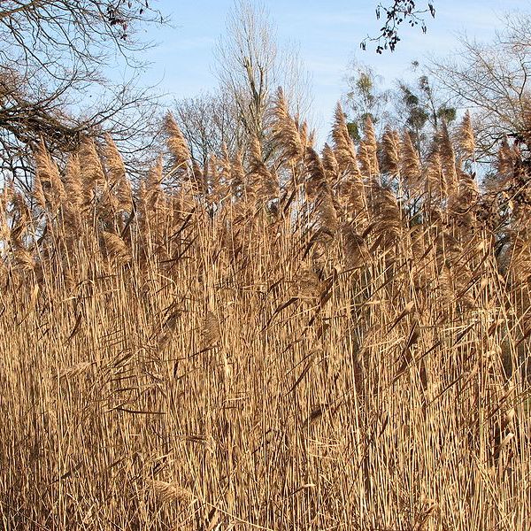
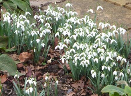
In the land where I live, spring awakes. Snowdrops in their prime unfold the voluminous skirts of their lanterns. Lords and ladies push their courtship through the soil alongside first signs and scents of ransoms. Swollen mosses take on a bright green living vibrancy.

As I walk the path centuries of ancestors walked to St Mary’s Well, I hear the loudness of a thrush. Could it be the one who calls me from sleep each morning, speckled chest blanched and white as birch amongst ash and sycamore? The trees hold back for now, but I know the sap will start rising soon.

I pass the site of the healing well and cross the road to the War Memorial. Splashes of pink, purple and yellow primroses are planted in beds before the Celtic cross. Etched on blue-grey slabs are the names of seventy-three men who lost their lives in the First World War and forty-six who died in the second. They are honoured and remembered here. I also think of the dead who have no memorial or whose memories have been erased or forgotten.

I follow the footpath uphill onto Church Avenue. Leading to St Mary’s Church, it once went to a Benedictine Priory, dissolved and more recently demolished. A strange road this; trodden by pilgrims in search of miraculous cures and by funeral processions. By soldiers too, maybe armies, defending this crucial position from what we now see as the castle motte.

Passing the church on the hill’s summit I stand in the graveyard amongst tilted and fallen headstones, beneath sentinel beech trees whose shells and bronzed and curling leaves still litter the greening earth.

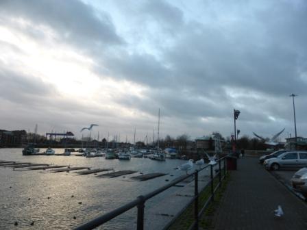
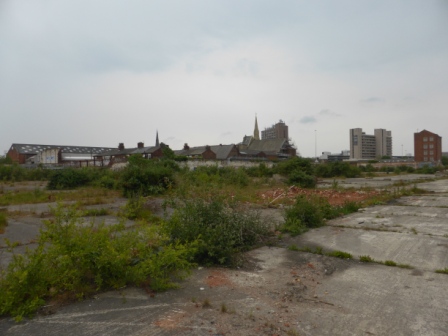
There’s no access to the motte’s vantage point, but through leafless trees I can make out the city of Preston with its clock tower, steeples, tower blocks and huge manufacturies along Strand Road. I recall images of its panoply of smoking chimneys, flaming windows, imagine the pounding Dickensian melancholy-mad elephants.

Preston’s sleeker now. Cleaner. Less red and black. Concrete grey. Not so smoky. But sometimes the industrial pall still holds. Somewhere behind its walls lies a medieval town and behind that…

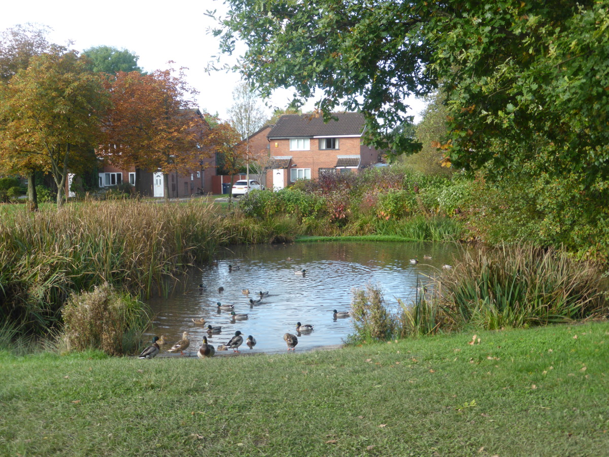
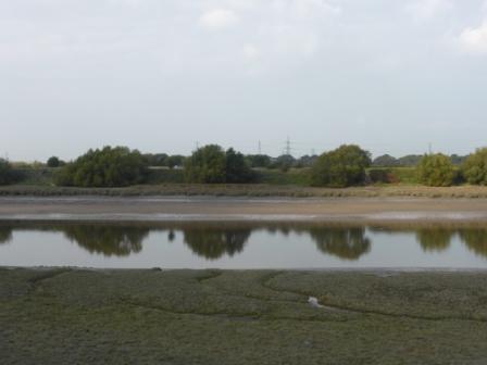
The Pennines form a sweeping backdrop, rising higher than Priest Town’s spires ever could; Parlick, Wolf Fell, Longridge Fell, Billinge Hill, Great Hill, Winter Hill. An easterly green and purple barricade. To the west, the river Ribble, Belisama, strapped into her new course, stretches long arms to her shining estuary. A sea gull cries over the horizon and disappears.

I’ve spent several years researching the history of Penwortham. The Riversway Dockfinds mark the existence of a Bronze Age Lake Village. Ballista balls on Castle Hill and a huge industrial site at Walton-le-dale ascertain a Roman presence. Following the breakdown of Roman rule, history grinds to a halt.

There is a black hole in Penwortham’s past the size of the Dark Ages; during the time of the Old North.

Historians have conjectured about this. David Hunt and Alan Crosby agree that place names (where we find a mixture of Brythonic and Old English, like Penwortham* often conjoined) suggest a gradual settlement of the local area by Anglo-Saxons during the seventh century. They say Penwortham’s remoteness on the edges of Northumbria and Mercia meant it was not a major concern. However, this conflicts with the significance of its location as a defensive position for the early Britons and Romans and later probably for the Saxons of Mercia and the key role it played for the Normans during the harrying of the North.

History starts up again with the Saxon hundreds, invasions from Scandinavia and the Norman Conquest. But what happened in between?

Unfortunately, likewise, there is a black hole in the history of the Old North the size of Penwortham. And it isn’t the only one.

The very concept of ‘Yr Hen Ogledd’ ‘the Old North’ is problematic. It is a term used post datum by scholars to identify an area of land covering the majority of northern England and southern Scotland from the time of the breakdown of Roman rule in the fifth century until the Anglian kingdom of Northumbria came to dominate in the eighth century.

During this period, it was simply known as ‘Y Gogledd’ ‘the North’. Its people spoke a Brythonic language known as Cumbric, which was similar to the Cymric language of the Welsh. Its rulers ‘Gwŷr y Gogledd’ ‘the Men of the North’ claimed common descent from either Coel Hen (Old King Coel) or Dyfnawl Hen. Again, the genealogies are problematic because they were created by kings to certify their reign by tracing their lineage back to legendary ancestral figures.

The main kingdoms of the Old North are usually identified as Alt Clud, in the south-west of Scotland, which centred on Dumbarton and later became Strathclyde; Gododdin, in the south-east of Scotland, which had a base at Edinburgh; Elmet, in western Yorkshire and Rheged in north-west England.

The location of Rheged is a matter of ongoing debate. For Ifor Williams it centres on Carlisle and the Eden Valley and covers Cumbria, the Solway Firth and Dumfries and Galloway. John Morris posits the existence of a northern Rheged in Cumbria and a southern Rheged that extended into Lancashire and Cheshire. On the basis of landscape and resources, Mike McCarthy suggests a smaller kingdom or set of sub-kingdoms existed either north or south of the Solway. If McCarthy is correct, we do not have a name for present day Lancashire at all but a black hole the size of a county or larger!

Another problem is that textual sources about the Old North are extremely limited. We have some historical records such as the Annales Cambriae, the Historia Brittonum and Anglo-Saxon Chronicle. Much of the history of this period is derived from the heroic poetry of the Dark Age bards Taliesin and Aneirin. Later saga poetry construes dramatic dialogues between characters associated with earlier events.

Research leads to where history and myth converge but can take us no further. It becomes necessary to step beyond study across the threshold to otherworlds where the past, our ancestors and deities still live.

So I speak my intentions to the spirits of place; the Lady in the Ivy with her glance of green, wood pigeons gathered in the trees, the people buried here in marked and unmarked graves.

I speak with my god, Gwyn ap Nudd, who abides beyond this land but sometimes seems closer than the land itself. The god who initiated and guides this quest.

His suggestion: what is a black hole but a portal?

Our agreement stirs a ghost wind from behind the graves, rustling bronze beech leaves and tree whispers from above.

The hill seems greener. A single white sea gull barks. Then long-tailed tits come chittering and twirling to the brambles.

Beech trees and castle motte*Penwortham first appears in the Domesday Book in 1086 as ‘Peneverdant.’ Writing in 1857 Rev. W. Thornber claims this name is of British origin and ‘formed of three words- pen, werd or werid and want, as Caer werid, the green city (Lancaster) and Derwent, the water, that is the green hill on the water’. This describes exactly how I imagine Castle Hill would have looked during the eleventh century near the Ribble on the marsh. However, ‘verdant’ has always sounded more like French for ‘green’ to me.

Alan Crosby says ‘Peneverdant’ results from a Norman scribe trying to write an unfamiliar word (which was likely to have been in use for up to 500 years) phonetically. He tells us the ‘Pen’ element in Penwortham is British and means ‘prominent headland’ whilst ‘wortham’ is Old English and means ‘settlement on the bend in the river’.

If Penwortham had an older British name prior to Saxon settlement, it is unknown. I can’t help wondering if it would have been something like ‘y pen gwyrdd ar y dŵr,’ which is modern Welsh for ‘the green hill on the water’. It’s not that far from Peneverdant.