Penwortham Priory and the Rule of Saint Benedict

You wouldn’t know it had ever been there if wasn’t for the street names Priory Lane, Priory Close, Priory Crescent, Monk’s Walk, and the names of Priory Park Care Home and Penwortham Priory High School (where I was educated between 11 and 16 and from where I tried to escape as often as possible!).

Castle Hill, the pen, the prominent headland, which puts the ‘Pen’ in Penwortham has been the town’s central religious and defensive site for thousands of years. The castle mound remains along with St Mary’s Church and graveyard, but Penwortham Priory and its black-robed monks are long gone.

St Mary's Church

Penwortham Priory was founded in the 1140s when Warin (de) Bussel, a Norman Lord who was the first Baron of Penwortham, transferred St Mary’s Church to the Benedictine abbey of Evesham in Worcestershire. The abbot funded the building of the priory and sent a prior and three monks to serve.

The priory was an ‘obedience’ of Evesham Abbey and had no independence of its own. Because it was replaced with a mansion after the dissolution we do not know what it looked like. Alan Crosby suggests it is was a ‘monastic grange with a chapel… built around a quadrangle in some form of cloister.’

Penworthampriory_authorunknown_wikipedia

Penwortham Priory rebuilt as a mansion

The priors and monks were often sent from the larger and richer abbey (where there were sixty-seven monks, five nuns, three clerks, and sixty-five servants) as a punishment. This bleak north-western headland, overlooking Penwortham Marsh and the tidal Ribble, must have been cold and wet and probably felt like the end of the world in contrast to Evesham.

We know little about Penwortham’s monks and priors. The priors’ names are listed from Henry in 1159 to Richard Hawkesbury, who withdrew before the dissolution of the priory in 1539. Those whose lives have warranted comment are a ‘good-hearted’ Prior Wilcote who fed his monks up after periodical blood-letting (this disturbingly suggests he was the exception) and a notorious prior called Roger Norris.

Norris was described as ‘a glutton, wine-bibber, and loose-liver’ who could nevertheless through eloquence and courtly manners put on a show of learning. After betraying his brethren at Christ Church, Canterbury, and being imprisoned, he escaped through a sewer. Richard I made him abbot of Evesham and he ‘dissipated its revenues until the monks were reduced to a diet of bread and water… for lack of decent clothing many of them could not appear in the choir or chapter house.’

Norris was eventually removed from his position and instead made prior of Penwortham where he continued in his excesses, being deposed then reinstated until 1223, when he died refusing to be reconciled to the abbot of Evesham and withholding certain revenues that belonged to the abbey.

Although there are no records of the everyday lives of the monks of Penwortham Priory we can gain insights into their routine and religious values by examining the life and rule of St Benedict and the Benedictine movement.

***

Benedict was born in Nursia, in Italy, in 480. He was sent to Rome to study but, disappointed by the immoral lives of his companions, he decided to leave and become a hermit. He departed for Enfide and, on his way through a narrow valley, met with Romanus of Subiaco, who lived in a monastery on the cliff. Subiaco gave Benedict his monk’s habit and counselled him to live in the cave beneath the cliff.

423px-Meister_von_Meßkirch_002

Between the summit and the clear blue lake beneath Benedict lived alone for three years with Romanus bringing him food. Afterwards, when the monks of another nearby monastery asked him to become their abbot, he reluctantly agreed, but because of their ‘diverse manners’ they did not get on and attempted to poison him. Benedict prayed a blessing over the poisoned cup and it shattered.

When he returned to his cave a jealous priest called Florentius tried poisoning him with poisoned bread, but he prayed another blessing and a raven flew down and took the loaf away. When Benedict attracted his own followers Florentius tried to seduce them with prostitutes and failed.

To avoid further persecution Benedict left Subiaco and established 12 monasteries nearby. In 530 he founded the monastery of Monte Cassino where he died of a fever on the 21st of March in 543 or 547.

800px-Monte_Cassino_Opactwo_1

Benedict originally wrote his Rule for autonomous self-governing communities. Its 56 chapters form guidelines regulating the daily offices of prayer, work, sleep, meals, clothing, possessions, and behaviour.

After his death Benedictine monasticism grew rapidly in popularity throughout Europe and was brought to England by Saint Augustine, who was sent by Pope Gregory I to Christianise the pagan Anglo-Saxons. He founded the first Benedictine monastery in Canterbury and became its abbot in 597.

Saint Wilfrid, the first English Christian to visit Rome in 658, enforced the Roman method for calculating Easter and introduced the Rule of Saint Benedict in his monasteries at Ripon and Hexham. Wilfrid was granted lands ‘iuxta Rippel’ ‘by the Ribble’ at Preston (Preosta Tun ‘Priest Town’) across from Penwortham. The parish church was dedicated him and he became the town’s patron saint. However, there is no evidence that Wilfrid set up any Benedictine monasteries in the local area.

Evesham Abbey was built by St Egwin between 700 and 710 after a swineherd called Eog experienced a vision of the Virgin Mary. Thus its link to St Mary’s in Penwortham is of interest.

320px-Evesham_Abbey_Bell_Tower

The Order of Saint Benedict was founded in 910 by the abbot of Cluny and this is when it became centralised.

152 Benedictine monasteries and 52 nunneries were established across England. They became important seats of learning and literature and sanctuaries for holy relics and works of art. It was partly because of their wealth and power that King Henry VIII dissolved them between 1536 and 1541.

***

From the Rule of St Benedict we can guess the monks of Penwortham performed eight offices of prayer a day: Matins (midnight), Lauds (dawn), Prime (early morning), Terce (mid-morning), Sext (midday), None (mid-afternoon), Vespers (evening), Compline (bedtime). They would have performed no less than five hours of manual labour. Eating the flesh of four-legged animals was banned. The usual fare was a pound of bread and quarter litre of wine (which I imagine was supplemented with seasonal fruit and vegetables and fish from the fisheries and panneries). They lived by strict vows of obedience, stability, and chastity, and the renunciation of all worldly possessions.

I have often wondered what led them to becoming monks. The call of God? The promise of a life rich in religion and art? The guarantee of safety and stability in a harsh and war-torn world? Did they find God, Jesus, Mary, here on this lonely hill as the rain poured and fires burnt low in the grates?

Did any of them sense the presence of the ancient goddess of the hill, the marsh, the healing well, or the otherworldly god and his spirits who would later be seen marching in a fairy funeral procession?

As an awenydd I can understand the appeal of leading a life of prayer in community in devotion to one’s god(s). However, I cannot imagine wanting to be part of an Order founded on the elimination of a multitude of local variants of Christianity, which in turn eliminated a multitude of local variants of paganism.

When I visit the sites of priories and abbeys I often feel a combination of yearning and sorrow. The yearning to be a part of something big, to participate in shared devotion, to find and wonder in the same god. Yet I also feel saddened by the weight of destruction that has brought this hegemonic religion about. All the gods and spirits and the diverse sets of beliefs that have been crushed, wiped out.

Whilst I long for a devotional community I could never join a Christian monastery or a pagan, polytheistic or druidic order that is based on or even inspired by Christian monastic ideals and principles as it these very things that have cast out and demonised the gods and spirits within the landscape.

Thus I remain a solitary devotee of those deities within the land, beneath the church, beneath the roads and street names that mark where the feet of monks once trod and where they tread no longer.

Monks Walk


SOURCES

Alan Crosby, Penwortham in the Past, Carnegie Press, (1988)
Saint Benedict, Rev. Verheyen Boniface (transl), The Rule of Saint Benedict, (Christian Classics Ethereal Library, 1923)
William Farrer and J Brownbill (ed.), ‘Houses of Benedictine monks: The priory of Penwortham’, A History of the County of Lancaster: Volume 2, (London, 1908)
Benedict of Nursia, Wikipedia

Teyrnllwg: A Bright Kingdom Slips Away Like Dust

A couple of weeks ago something immensely exciting happened: I received a response to queries on my blog regarding the black hole in the post-Roman history of Lancashire. A Penwortham resident called Ozrico told me the area between the Ribble and the Dee was known as Theyrnllwg. It belonged to the Britons until the Battle of Chester in 613 where its king, Brocmail, took on the Saxon king, Aethelfrith (and lost).

Therynllwg! I thought I had finally found the lost name of the kingdom to which south Lancashire belonged. Not only that, I had the name of its king!

Searching the internet, I found two sources for Theyrnllwg. The first was Charles Onam’s England Before the Norman Conquest (1921). Onam said ‘the lands between the Ribble and the Dee’ were ‘originally known as Therynllwg, of which the later Powys was the surviving remnant. It then extended from the Ribble to the Upper Wye, and from the Clwyd to Cannock Chase, and had been for a century a connecting link between the Britons of the North and those of the West.’

Onam’s words extended the territory of Theyrnllwg into Wales and were doubly exciting because for the first time I had found scholarship stating the area we now know as Lancashire formed a link between Wales and the Old North. This would have meant people had a connecting route (or routes) by which to trade and on their travels would have shared myths and stories. In relation to my on-going quest to uncover Gwyn ap Nudd’s forgotten connections with the Old North, if he was known in Wales and by the Strathclyde Britons this would have made it likely he was known in Lancashire too.

Through a reference in the footnotes, I traced Onam’s words back to William Stubbs’ Origines Celticae (1883) where I found within a list of Welsh names of districts ‘Theyrnllwg from Aerfen to Argoed Derwenydd’ (the river Arfon in Gwynedd and the woodland of the river Derwent in Cumbria?). This extended Theyrnllwg further and led to more sources. Stubbs said the list originated from the ‘Iolo MSS’ and this was ‘taken from a MS belonging to Mr Cobb of Cardiff, and is a mere fragment, a page of the MS having been torn out.’

Having obtained as much information as I could on the internet, I contacted Heron (who lives in Wales and is knowledgeable on such matters) and asked if he knew anything about Theyrnllwg. When I received his answer I was greatly disappointed.

Heron replied saying the name Theyrnllwg derives from Teyrnllwg and sent me an extract from Peter Bartrum’s A Welsh Classical Dictionary (1994). Bartrum stated Teyrnllwg was an ‘imaginary territory’ derived from the name of Cadell Ddyrnllug, a prince of Powys mistakenly taken to be its ruler.

I found out Cadell Ddyrnllug first appeared in Nennius’ History of the Britons (830) as Catel Durnluc, a servant of the tyrannical king of Powys, Benlli. When St Germanus arrived to remonstrate Benlli, Castel offered him hospitality. After Benlli, his city and his subjects had been burned by fire from heaven, Germanus rewarded Castel for his hospitality by making him king. This fulfilled ‘the prophecy of the Psalmist: “He raiseth up the poor from dust, and lifteth the needy out of the dunghill”.’

Bartrum said in modern Welsh Durnluc would take ‘the form Ddyrnlluch or Ddyrnllug, meaning ‘gleaming hilt’, from dwrn, ‘hilt’ and lluch, ‘gleaming’ or llug, ‘bright’. The meaning evidently became obscure very early, and was perhaps interpreted as derived from teyrn, ‘prince’ and llwch, ‘dust’. This may have been the basis of the legend which derived Cadell from a humble origin, the author actually quoting Psalm 113 vv.7.8.’

The name Teyrnllwg was later and erroneously identified as Teyrnllwg’s kingdom. When I looked it up on the internet, I found a pamphlet titled The Fictitious Kingdom of Teyrnllwg (1960) by Melville Richards reprinted for Transactions of the Lancashire and Cheshire Antiquarian Society which provided further explanation.

The Fictitious Kingdom of TeyrnllwgIn its two pages Richards criticises an earlier article by Dr. J . D. Bu’Lock which ‘recreates the history of ‘The lost kingdom of Teyrnllwg’’ saying he has been misled by ‘the comparative validity and authenticity of the Welsh material’ (ie. the Iolo MS). ‘Dyrnllug is an epithet which can be readily analysed as dwrn (‘fist’) and llug (‘bright’), referring to some (?) physical characteristic of Cadell… By the fifteenth century Dyrnllug had become Deyrnllug in the genealogical lists.’

Teyrnllwg became accepted as a ‘territorial designation’ firstly because teyrn means ‘king, ruler’ and secondly because -wg was a common territorial suffix (ie. Morgannwg ‘country of Morgan’). Whilst Richards accepted the possible existence of a kingdom in the area of Cheshire and Lancashire he stated adamantly ‘its name was not Teyrnllwg’.

The existence of Teyrnllwg, kingdom of a prince with a bright and gleaming hilt or fist who rose from dust was well and truly refuted. (Although it continues to exist in the gleaming brightness of the name. The glamoury of a bright kingdom slipping away like dust…)

***

However a loose end remained to be tied up. If Teyrnllwg was fictitious what about Brocmail, its king? Oman said Brocmail is the son of Cincen, a descendant of Cadell. I discovered this was backed up by the Harleian MS 3859: The Genealogies, where he appears in the lineage of the rulers of Powys ‘[S]elim map Cinan map Brocmayl map Cincen map Maucanu map Pascent map Cattegirn map Catel dunlurc.’

It was also likely Brocmail was present in the Battle of Chester. In Bede’s Ecclesiastical History of the English People (8th C) Brocmail was the guard of 1200 monks from Bangor who had come to pray for the Welsh army. When the Saxon ruler Aethelfrith commanded his army to slaughter them, Brocmail fled, escaping with fifty.

The Anglo-Saxon Chronicle (9th C) stated Scromail (a mis-spelling of Brocmail?) was the leader of the Welsh. After Aethelfrith slew ‘countless Welsh’ and ‘200 priests’ ‘he escaped as one of fifty.’ In Geoffrey of Monmouth’s The History of the Kings of Britain (1136) Brocmail was Earl of Leicester and the battle took place in Leicester. Brocmail made a stand against Aethelfrith, in spite of having less soldiers, and only fled after he had ‘inflicted exceeding great slaughter upon the enemy.’ This version also mentioned ‘one thousand two hundred monks’ were killed.

As Brocmail is listed as a king of Powys, it seems more likely he was a leader in the battle than a guard. Nick Higham notes Bede is unreliable because he is more concerned about writing ‘providential history’ than military reality and is dubious about the slaughter of the monks. This makes it possible Brocmail’s deposition from a British king who faced the Saxons to a cowardly guard reflects his bias. (However it is equally possible Monmouth’s glorification of him as a British king is biased too…).

Archaeological evidence from Heronbridge, near Chester (a group of skeletons with clear signs of violent injury buried in a pit, believed to be the dead of the Saxon victors) demonstrates the battle took place in Chester and not Leicester. From this we can derive that the Battle of Chester really took place, Brocmail took part in it, and at this pivotal point Cheshire, and perhaps south Lancashire, first became subject to Saxon rule.

Brocmail’s involvement in the Battle of Chester also demonstrates these areas had real political links with Powys. This is supported by the fact when the Mercian Saxons took rule, they formed an alliance with the rulers of Gwynedd and Powys to take on Oswald and the Saxons of Northumbria at Maserfelth (Makerfield in Lancashire). It seems likely they were drawing on a pre-existing alliance.

Whilst the kingdom of Terynllwg may be dismissed as fictitious, the name provides important clues to links between rulers of Powys and the Britons of Cheshire and Lancashire.

***

A more realistic picture of these post-Roman British territories is drawn by Denise Kenyon in The Origins of Lancashire (1991). Kenyon notes attempts to locate Teyrnllwg in north-west England are not widely accepted. She goes on to suggest that concentrations of British place-names may be used to identify areas of lordship.

She posits three main territories. The first centres around Makerfield and Wigan and extends into the Leyland and Newton hundreds down to the Mersey (I assume its northern limit is the Ribble). The second includes the Fylde and centres on ‘Preese and Preesall, Greater and Little Eccleston and Inskip.’ There are two groups in Greater Manchester; around Manchester itself and ‘on the edge of the Rossendale forest’.

A further possibility is that ‘iuxta Rippel was in origin a small British kingdom or lordship encompassing the west Lancashire lowlands on either side of the Ribble, as far south as Makerfield, and extending into the Pennine foothills above Whalley’. These British lordships would have formed the basis for later Anglo-Saxon territorial units.

Kenyon identifies my home town of Penwortham as a ‘central place’ occupying a nodal position in the communication network on a crossing of the Ribble. She says its name is of interest as a hybrid of British and English: ‘Pen’ is British and means ‘hill’ whilst ‘ham’ is English and means ‘safe place’.

‘Ham’ names are indicative of ‘central places’ connected with ‘Roman military and industrial settlements’ (in Penwortham’s case Walton-le-dale) and are often seats of ancient parishes. The construction of the name reflects the acculturation of an important British ‘central place’ by the English.

Thus we have a picture of post-Roman Penwortham lying either on the northern edge of a British lordship centring around Makerfield or in the midst of iuxta Rippel. Differences between the dialects north and south of the Ribble (ie. ‘chester’ to the south and ‘caster’ to the north) make the former seem more probable. This lordship would have been taken over by the Saxons some time after the Battle of Chester. The ‘wahl’ element of Walton-le-dale suggests a strong British presence remained in this town, adjacent to Penwortham.

Kenyon’s identification of Penwortham as a central place on the communication network re-opens the possibility of it linking Wales and the North. Whilst most historians are dubious about connection by road due to boggy ground, the river Ribble was no doubt used for transport and communication with Penwortham as a look-out point and possible port.

Is there any way of making a case that the Britons of the lordship centring on Makerfield once shared a pagan mythology and told similar stories to those further north and in Wales?

The only evidence of native British pagan worship in the vicinity comes from Romano-British altars, statues and inscriptions to deities such as Deae Matronae (the mother goddesses), Apollo-Maponus (Maponos was a Brythonic god of youth) and Mars-Nodontis (Nodens was a Brythonic god of hunting and healing and is cognate with Nudd, Gwyn’s father). These are not in our Makerfield lordship but north of the Ribble in the Fylde.

That Kenyon believes the Anglo-Saxon ecclesiastical divisions are likely to have been founded on earlier British ones (drawing on the etymology of Eccles from eglys ‘church’) and monks from Bangor were praying for the Welsh army suggests the Britons had been Christian before the English arrived in 613.

How and when they were converted (or chose to convert) remains a matter for further investigation. Insights in this direction may throw light on how the ancient British gods and goddesses slipped from the consciousness of the people of my locality like the bright dust of Terynllwg.

The Old North from Peneverdant

SnowdropsIn the land where I live, spring awakes. Snowdrops in their prime unfold the voluminous skirts of their lanterns. Lords and ladies push their courtship through the soil alongside first signs and scents of ransoms. Swollen mosses take on a bright green living vibrancy.

As I walk the path centuries of ancestors walked to St Mary’s Well, I hear the loudness of a thrush. Could it be the one who calls me from sleep each morning, speckled chest blanched and white as birch amongst ash and sycamore? The trees hold back for now, but I know the sap will start rising soon.

I pass the site of the healing well and cross the road to the War Memorial. Splashes of pink, purple and yellow primroses are planted in beds before the Celtic cross. Etched on blue-grey slabs are the names of seventy-three men who lost their lives in the First World War and forty-six who died in the second. They are honoured and remembered here. I also think of the dead who have no memorial or whose memories have been erased or forgotten.

I follow the footpath uphill onto Church Avenue. Leading to St Mary’s Church, it once went to a Benedictine Priory, dissolved and more recently demolished. A strange road this; trodden by pilgrims in search of miraculous cures and by funeral processions. By soldiers too, maybe armies, defending this crucial position from what we now see as the castle motte.

Passing the church on the hill’s summit I stand in the graveyard amongst tilted and fallen headstones, beneath sentinel beech trees whose shells and bronzed and curling leaves still litter the greening earth.

There’s no access to the motte’s vantage point, but through leafless trees I can make out the city of Preston with its clock tower, steeples, tower blocks and huge manufacturies along Strand Road. I recall images of its panoply of smoking chimneys, flaming windows, imagine the pounding Dickensian melancholy-mad elephants.

Preston’s sleeker now. Cleaner. Less red and black. Concrete grey. Not so smoky. But sometimes the industrial pall still holds. Somewhere behind its walls lies a medieval town and behind that…

The Pennines form a sweeping backdrop, rising higher than Priest Town’s spires ever could; Parlick, Wolf Fell, Longridge Fell, Billinge Hill, Great Hill, Winter Hill. An easterly green and purple barricade. To the west, the river Ribble, Belisama, strapped into her new course, stretches long arms to her shining estuary. A sea gull cries over the horizon and disappears.

I’ve spent several years researching the history of Penwortham. The Riversway Dockfinds mark the existence of a Bronze Age Lake Village. Ballista balls on Castle Hill and a huge industrial site at Walton-le-dale ascertain a Roman presence. Following the breakdown of Roman rule, history grinds to a halt.

There is a black hole in Penwortham’s past the size of the Dark Ages; during the time of the Old North.

Historians have conjectured about this. David Hunt and Alan Crosby agree that place names (where we find a mixture of Brythonic and Old English, like Penwortham* often conjoined) suggest a gradual settlement of the local area by Anglo-Saxons during the seventh century. They say Penwortham’s remoteness on the edges of Northumbria and Mercia meant it was not a major concern. However, this conflicts with the significance of its location as a defensive position for the early Britons and Romans and later probably for the Saxons of Mercia and the key role it played for the Normans during the harrying of the North.

History starts up again with the Saxon hundreds, invasions from Scandinavia and the Norman Conquest. But what happened in between?

Unfortunately, likewise, there is a black hole in the history of the Old North the size of Penwortham. And it isn’t the only one.

The very concept of ‘Yr Hen Ogledd’ ‘the Old North’ is problematic. It is a term used post datum by scholars to identify an area of land covering the majority of northern England and southern Scotland from the time of the breakdown of Roman rule in the fifth century until the Anglian kingdom of Northumbria came to dominate in the eighth century.

During this period, it was simply known as ‘Y Gogledd’ ‘the North’. Its people spoke a Brythonic language known as Cumbric, which was similar to the Cymric language of the Welsh. Its rulers ‘Gwŷr y Gogledd’ ‘the Men of the North’ claimed common descent from either Coel Hen (Old King Coel) or Dyfnawl Hen. Again, the genealogies are problematic because they were created by kings to certify their reign by tracing their lineage back to legendary ancestral figures.

The main kingdoms of the Old North are usually identified as Alt Clud, in the south-west of Scotland, which centred on Dumbarton and later became Strathclyde; Gododdin, in the south-east of Scotland, which had a base at Edinburgh; Elmet, in western Yorkshire and Rheged in north-west England.

The location of Rheged is a matter of ongoing debate. For Ifor Williams it centres on Carlisle and the Eden Valley and covers Cumbria, the Solway Firth and Dumfries and Galloway. John Morris posits the existence of a northern Rheged in Cumbria and a southern Rheged that extended into Lancashire and Cheshire. On the basis of landscape and resources, Mike McCarthy suggests a smaller kingdom or set of sub-kingdoms existed either north or south of the Solway. If McCarthy is correct, we do not have a name for present day Lancashire at all but a black hole the size of a county or larger!

Another problem is that textual sources about the Old North are extremely limited. We have some historical records such as the Annales Cambriae, the Historia Brittonum and Anglo-Saxon Chronicle. Much of the history of this period is derived from the heroic poetry of the Dark Age bards Taliesin and Aneirin. Later saga poetry construes dramatic dialogues between characters associated with earlier events.

Research leads to where history and myth converge but can take us no further. It becomes necessary to step beyond study across the threshold to otherworlds where the past, our ancestors and deities still live.

So I speak my intentions to the spirits of place; the Lady in the Ivy with her glance of green, wood pigeons gathered in the trees, the people buried here in marked and unmarked graves.

I speak with my god, Gwyn ap Nudd, who abides beyond this land but sometimes seems closer than the land itself. The god who initiated and guides this quest.

His suggestion: what is a black hole but a portal?

Our agreement stirs a ghost wind from behind the graves, rustling bronze beech leaves and tree whispers from above.

The hill seems greener. A single white sea gull barks. Then long-tailed tits come chittering and twirling to the brambles.

Beech trees and castle motte*Penwortham first appears in the Domesday Book in 1086 as ‘Peneverdant.’ Writing in 1857 Rev. W. Thornber claims this name is of British origin and ‘formed of three words- pen, werd or werid and want, as Caer werid, the green city (Lancaster) and Derwent, the water, that is the green hill on the water’. This describes exactly how I imagine Castle Hill would have looked during the eleventh century near the Ribble on the marsh. However, ‘verdant’ has always sounded more like French for ‘green’ to me.

Alan Crosby says ‘Peneverdant’ results from a Norman scribe trying to write an unfamiliar word (which was likely to have been in use for up to 500 years) phonetically. He tells us the ‘Pen’ element in Penwortham is British and means ‘prominent headland’ whilst ‘wortham’ is Old English and means ‘settlement on the bend in the river’.

If Penwortham had an older British name prior to Saxon settlement, it is unknown. I can’t help wondering if it would have been something like ‘y pen gwyrdd ar y dŵr,’ which is modern Welsh for ‘the green hill on the water’. It’s not that far from Peneverdant.

Imagine the Old North

Imagine the Old North. What can it be? Can you see it in this land, from your green hill across the marsh how the ordinary people saw it?

Can you see ravens in trees amongst the crows? Was it common enough for magpies?

Can you imagine the rumours of embittered warlords and honey-tongued bards who sung their praises? Can you taste weak beer or braggot? Do you feast on dog or wild boar?

Can you imagine living in a world where the animals speak? How will you learn their tongues? Will they lead you into their expanses?

Your books are filled with stories. Can you imagine the ones who got away? How their hearts beat on river-banks and they were pierced by spears as carrion birds circled? How the sleek otter swept into the depths and carried their death-cries to his young? Can you imagine what the ravens whispered in their thatched nest?

Can you imagine the task of bringing peace to the battle-dead?

Where all the darkness of history wanders and I hold the spirits of Annwn back… can you imagine?

What can our poetry be? A sound, a scream, a panorama of the Old North in a beam of light?

River Ribble from the Ribble Way, east of Ribchester Bridge
*Questions posed by Gwyn ap Nudd.
**Photograph of the river Ribble from the Ribble Way east of Ribchester Bridge.

Penwortham By-Pass and the City Deal

Today I went to a consultation organised by South Ribble Borough Council at Kingsfold Community Centre about changes to the planning of a new section of Penwortham By-pass. When I received an invitation through the post I was surprised as this was the first time I had been made aware of the original plan, let alone the new one.

The rescinded route was to run from Broad Oak Roundabout in Penwortham, across Lindle Lane, several fields, part of Bamford’s Wood, then across Saunders Lane to join a new roundabout on the A59 close to Chapel Lane in Longton.

Penwortham By-pass Original Rescinded Route

Rescinded Route, Courtesy of South Ribble Borough Council

The new route will run from Broad Oak Roundabout, north of Lindle Lane and just north of Mill Brook. After crossing a series of fields it will join the A59 near to Howick Cross.

New Route of Penwortham By-pass

New Route, Courtesy of South Ribble Borough Council

The proposal (1) states an extra section of by-pass is needed to divert traffic away from Penwortham and residential and shopping areas on the A59, to improve conditions for residents, pedestrians and cyclists and reduce road casualties.

Reasons for the change of plan include not demolishing five houses; a smaller environmental impact with less loss of land; half a mile shorter; a more direct route to a new Ribble crossing.

All well and good. But why do we ‘need’ this new stretch of by-pass in the first place? This assumption is based on the premise that we need to prioritise economic development. This is the purpose of the City Deal.

‘The Preston, South Ribble and Lancashire City Deal is an ambitious programme of work that builds on the strong economic performance of the area over the last ten years and will help ensure the area continues to grow by addressing major transport issues to deliver new jobs and housing. Over a ten-year period the deal will generate more than 20,000 jobs, over 17,000 homes and more importantly grow the local economy. With the funding certainty it brings, we are able to deliver these transport improvements sooner we would otherwise be able to. This means new homes and jobs can come sooner and we can reduce congestion on existing roads and improve areas for communities and road users.’

Let’s pause to look at the bigger picture. This is a map of the overall plan for the City Deal over the next ten years.

City Deal Map, courtesy of South Ribble Borough Council

City Deal Map, courtesy of South Ribble Borough Council

The piece of by-pass in question is outlined in darker red close to the number 4. Its ultimate aim is to link to a new piece of road from Howick Cross to a new bridge over the River Ribble, across Lea Marsh to join the M55 at Swillbrook.

Lea Marsh is home to numerous birds and an area of environmental importance. I was assured that if it was built on, another nature reserve would be created in its place. Surely there can be no real compensation for an irreplaceable piece of land and its inhabitants?

This new piece of road will improve access to BAE and other businesses at Warton. BAE play a major part in the Lancashire Enterprise Partnership (2).

I found it somewhat chilling when I learnt this was the reason there was no junction built on the M55. It seems this was all been planned a long, long time ahead…

I’ve got a form to fill out now. Aside from minor details my only real chance to share my opinion is in a box labelled ‘Please tell us any issues that you think may affect our proposed route for the completion of Penwortham By-pass.’

There is no clear room for objection; to the by-pass or to the premise that economic development is the right or only way forward.

There is no way of arguing for alternative improvements to public transport. ‘Even with a greater investment in public transport, cycling and walking, our current roads will not be able to cope.’

It seems this consultation is a symbolic gesture and the decision that we must have one road or the other has already been made far in advance.

(1) City Deal, Preston, South Ribble and Lancashire, Share your views on the proposals for the completion of Penwortham By-pass (August 2014)
(2) http://www.lancashirelep.co.uk/media/8787/LEP-growth-plan.pdf p10

Gwyn ap Nudd and the Spirits of Annwn: Remembering the Underworld Gods

I recently came across an article through the Caer Feddwyd Forum (1) called ‘The Underworld Gods’ by medieval scholar, Will Parker. It brought to my awareness the existence of an inscription in Chamalieres in central France, which took the form of a prayer or invocation addressed to an entity or group of entities known in Ancient Gaul as the andedion, ‘the Under-world God(s)’ or ‘Infernal One(s)’ (2).

Parker links the andedion to the Irish andee ‘non-gods’ and suggests a similar group of deities would have been worshipped in Iron Age Britain. Through etymological links between the ‘elements Clt. dio(n) (Ir. dé) ‘god(s)’ and ‘the suffix ande-/an-‘ he connects them to Annwn ‘not world’, Britain’s indigenous otherworld or underworld. Parker goes on to identify the andedion and andee with the spirits of Annwn and their ruler, Gwyn ap Nudd.

This is of interest to me because Gwyn is my patron god. Parker’s insights make it possible to trace a trajectory from Iron Age beliefs concerning underworld gods, through Gwyn’s appearances in medieval literature and later folklore to those who worship him today.

Gwyn ap Nudd ‘White Son of Mist’ is a Brythonic deity. His veneration dates back, at least, to the Iron Age, where he appears as Vindonnus ‘White or Clear Light,’ in a trio of Gallo-Brythonic inscriptions in Essarois. Here he is equated with Apollo, another hunter deity (3). It is likely he was worshipped across Britain as Vindos ‘White’ (4). It has also been conjectured that Gwyn and his hunting dog, Dormarth ‘Death’s Door’ occupied the astrological positions of Orion and Sirius to the ancient Britons.

Cave, SilverdaleParker suggests Late Bronze Age ‘ritual shafts’ and ‘offering pits’ containing depositions including human and animal bones, grain, pottery and metalwork express a ‘quid-pro-quo’ relationship between the ancient Britons and the underworld gods. If he is correct, it is possible that Vindos / Gwyn, Dormarth and other kindred spirits were involved in these rites.

Gwyn’s first literary appearances are in medieval Welsh texts; ‘How Culhwch Won Olwen’ (11th C) in The Mabinogion and ‘The Dialogue of Gwyddno Garanhir and Gwyn ap Nudd’ (13th C) in The Four Ancient Books of Wales. These texts have roots in an older, oral tradition and contain fragments of tales from across Britain that predate Christianity. A significant number of these, including two featuring Gwyn, are from ‘The Old North’ (5). This is important to me because I connect with Gwyn in Lancashire.

Parker argues that superstitions about the underworld gods carry over into The Mabinogion. This is evidenced in the disappearance of livestock, children and crops. Pwyll’s encounter with Arawn, a King of Annwn, is the catalyst for the unfolding drama of the first four Mabinogi. Parker says these stories show the spirits of Annwn could not ‘be simply dismissed or ignored. Instead, a complex narrative had to be constructed in which, through a series of symbolic ritual manoeuvres, their power was drawn out, confronted and finally neutralised.’ The attempts of medieval scholars to disempower these deities can be seen at work in the development of Gwyn’s mythology.

In ‘The Dialogue of Gwyddno Garanhir and Gwyn ap Nudd,’ (6) Gwyn is presented as a divine warrior returning from battle to the Tawe near the vale of Neath. Gwyddno, ruler of Cantre’r Gwaelod, speaks of and addresses him with reverence and respect. ‘Bull of conflict was he, active in dispersing an arrayed army, / The ruler of hosts, indisposed to anger, / Blameless and pure was his conduct in protecting life.’ Other epithets Gwyddno uses include ‘hope of armies’ and ‘hero of hosts.’ ‘Host’ may refer to the spirits of Annwn.

Gwyn introduces himself as ‘Gwyn, the son of Nud, / The lover of Creurdilad, the daughter of Lud.’ He names his horse as ‘the torment of battle’ and refers to Dormarth as ‘truly the best of dogs,’ ‘handsome,’ ‘round bodied’ and ‘ruddy nosed.’ References to his possession of a ‘polished ring’ and ‘golden saddle’ are also suggestive of his status.

The title ‘Bull of Conflict’ refers to Gwyn’s role as a psychopomp. At the end of the poem he describes his travels across Britain gathering the souls of fallen soldiers. He appears to be berating this task. ‘I have been where the soldiers of Prydain were slain, / From the East to the North; / I am alive, they in their graves! / I have been where the soldiers of Prydain were slain / From the East to the South / I am alive, they in death!’

This poem contains important clues about Gwyn’s identity as a divine warrior and huntsman, whose role was to gather the souls of the dead and take them to Annwn.

In ‘How Culhwch Won Olwen’ in The Mabinogion, Gwyn is depicted as a huntsman and advisor to King Arthur. His place in Arthur’s court list and apparent subjection to both Arthur and God may be read as attempts by medieval scholars’ to explain and downgrade his position.

That ‘Twrch Trwyth will not be hunted until Gwyn son of Nudd is found’ (7) hints at his role as leader of the hunt, and knowledge of otherworldly beings. The Twrch was a king reputedly turned into a swine by God. When Gwyn does not reveal his location it is possible he is defending his own.

The advice of Gwyn and Gwythyr ap Greidol ‘Victor Son of Scorcher’ is also needed by Arthur to find Pennant Gofid in the ‘uplands of hell,’ which Evans and Bromwich say is ‘clearly situated in North Britain’ (8). When they reach this location, Gwyn and Gwythyr advise Arthur in his defeat of the ‘The Hag of Pennant Gofid,’ another otherworldly entity. The parcity of their advice, which leads to several failed attempts by Arthur’s men before the Christian King is forced to step in to slay her, may also suggest that Gwyn and Gwythyr are acting as tricksters.

A pair of lines fundamental to understanding Gwyn’s mythos, and which continue to intrigue and perplex me, are the following; ‘God has put the spirit of the demons of Annwfn in him, lest the world be destroyed. He will not be spared from there’ (9).

Taken literally, this seems to mean that at some point during the period of Christianisation God put the spirit of the demons of Annwn ‘in’ Gwyn’s person to prevent the world’s destruction. Or it may mean that he granted Gwyn rulership of them for this purpose. However, it is probable that the agency of God was brought in as a cover to excuse the prevalent belief in the existence of these spirits and their ruler.

Even if we assume God’s agency is a cover for existing beliefs, the notion that Gwyn somehow contains ‘the spirit of the demons of Annwn’ is a fascinating one. In a conversation via e-mail, Heron (10) told me the word ‘spirit,’ in Welsh, is ‘aryal,’ which can mean ‘ferocity,’ ‘essence’ or ‘nature’. He referred me to Evans and Bromwich, who say ‘Gwyn’s partaking of the ‘nature of the devils of Annwfn’ indicates a recognition on the part of the redactor of the tale that Gwyn ap Nudd belonged to a sinister and forbidden mythology’ (11). Within this mythology he may already be seen to embody the nature of these entities, or to hold power over them.

That the destruction of the world is at stake suggests Gwyn’s role was extremely significant. If it is assumed this notion has older roots, some of the offerings of the ancient Britons may be explained as attempts to placate these spirits and their ruler due to their destructive capacity. It is also possible Gwyn was invoked as the only being who could hold them in check.

Fears and superstitions surrounding Gwyn and the spirits of Annwn may lie behind the story of his abduction of Creiddylad. After Creiddylad, who is both Gwyn’s lover and sister, elopes with Gwythyr, Gwyn seizes her back. It might be assumed he takes her to Annwn, and that this suggests an underlying fear of being abducted by Gwyn and his forces.

Gwythyr amasses his armies and attacks Gwyn. Gwyn triumphs and captures a number of Gwythyr’s allies, who are mainly rulers of the Old North. During their captivity Gwyn slaughters Nwython, cuts out his heart and feeds it to his son, Cyledr, who goes mad. This could be read as a clear example of Gwyn’s ferocity and hints at existing superstitions about what goes on in Annwn.

Evans and Bromwich say the concentration of the names of people Gwyn kidnaps suggest ‘that north Britain was the ultimate place of origin for the Creiddylad episode, and that this incident was one of the surviving fragments of tradition emanating from there’ (12). It is therefore likely it originates in earlier beliefs held about Gwyn and his host by the Northern Britons.

Arthur eventually comes North to Gwythyr’s aid and frees his noblemen. Afterward he makes peace between Gwyn and Gwythyr by placing a dihenydd ‘fate’ on them. This dictates that they must fight for Creiddylad’s hand every Calan Mai ‘May Day’. An added condition, which seems particularly unfair, is that Creiddylad must remain in her father’s house, and no matter who wins neither can take her until Judgement Day. It is likely Arthur’s agency was brought in to explain an earlier myth, which was already prevalent in the Old North.

Whilst, on one level, this myth may be about fears of abduction to the underworld, it is more frequently interpreted as a seasonal drama comparable with Hades’ capture of Persephone. In this reading, Creiddylad is a maiden goddess who embodies the powers of spring and fertility. Creiddylad’s abduction by Gwyn may explain the failure of these powers at Calan Gaeaf, the first day of winter. Gwythyr and Arthur’s rescue of her at Calan Mai, the first day of summer, may explain their resurgence.
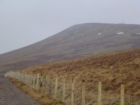
Winter Hill

Winter Hill

Gwyn is also seen as the Winter King. It is possible his white, shining qualities relate to snow and cold, associations which could date back to the Ice Age. Elen Sentier links Gwyn with the reindeer goddess Elen of the Ways (13) and the Boreal forest. He may also be connected with the North wind. The 14th C Welsh poet Dafydd ap Gwilim refers to ‘Tylwyth Gwyn, talaith y gwynt’ ‘the family of Gwyn, the province of the wind’ (14). The pervasiveness of a myth featuring Gwyn in Northern Britain could have a basis in its harsh winters.

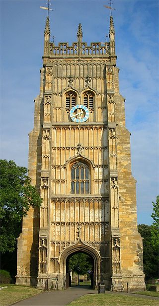
In a later text, The Life of St Collen (14th C), Gwyn is referred to as ‘the King of Annwn and the Fairies’ and is supposedly banished by the saint from Glastonbury Tor (15). The transition from belief in Gwyn as a King of Annwn to King of the ‘Tylwyth Teg’ or ‘Fair Folk’ is a significant one. The original natures of Gwyn and the spirits of Annwn are covered over by their reduction to diminutive form. However, hints at their mythos can still be found in the majority of folktales.

Gwyn retains his status as leader of the Wild Hunt in the folklore of Wales and Somerset. There he is seen to appear on horse back with a pack of white, red-eared hounds, riding out on Nos Calan Gaeaf and through the winter months, chasing down the souls of the dead. To hear his hounds is an omen of death. The other riders are seen often seen as captive souls and may represent the spirits of Annwn.

In the North West of England, however, the hunt is assigned either to the Norse god Odin, or to Christian angels. In Cumbria it is Michael, and in Lancashire and Yorkshire Gabriel is said to lead a pack of black, red-eyed dogs, the Gabriel Ratchetts.

Coincidentally, Preston born writer Francis Thompson is famous for a poem called ‘The Hound of Heaven.’ Anybody who has felt like Gwyn’s hounds are on their tail might find these lines hauntingly familiar; ‘I fled Him, down the nights and down the days; / I fled Him, down the arches of the years; / I fled Him, down the labyrinthine ways / Of my own mind; and in the mist of tears / I hid from him, and under running laughter.’ (16)

More recently, Gwyn’s significance as an ancient god has been attested by contemporary scholars such as Geoffrey Ashe, in King Arthur’s Avalon (2007) and Nicholas R. Mann in The Isle of Avalon (1996) and Glastonbury Tor (2012). He is also the subject of a full length book called Gwyn: Ancient God of Glastonbury and Key to the Glastonbury Zodiac (2007) by Yuri Leitch.

This increase in interest suggests we are approaching a time when Gwyn and the spirits of Annwn are taken seriously as Brythonic deities again. However, the main focus of these books is Gwyn’s role at Glastonbury, with only a small mention of his place in Wales and other areas of Britain. Disappointingly there is no mention of Gwyn’s activities in the North. In this respect I have only my own experiences and conjectures to go on.
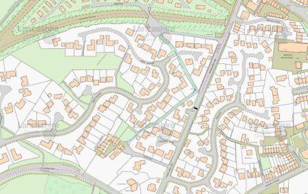
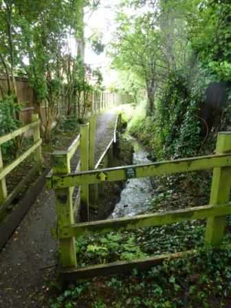
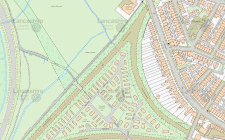
Fairy Lane

Fairy Lane

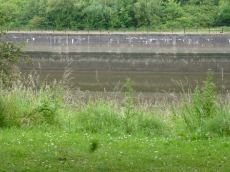
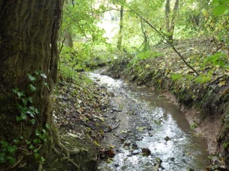
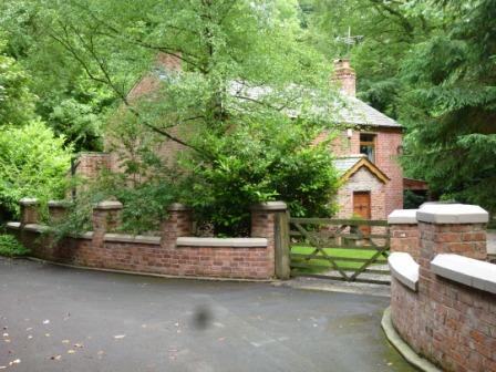
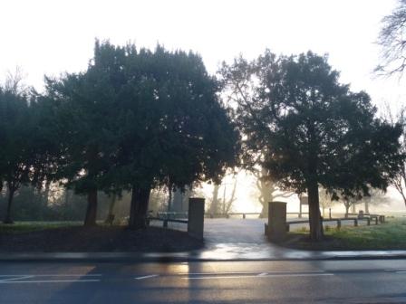
I first met Gwyn on Fairy Lane in my hometown of Penwortham, where he challenged me to journey with him to Annwn. Since then I have worked with him as a guide to the otherside of my local landscape and its hidden myths. His interest in my locality surprised me at first. However, it seems less surprising when looked at in the context of his role as an ancient underworld god of Britain, particularly in relation to the history and folklore surrounding this site.

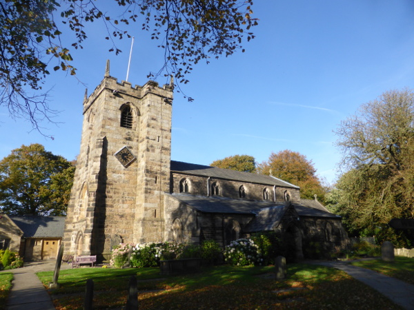
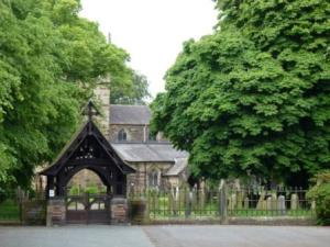
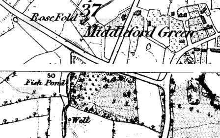
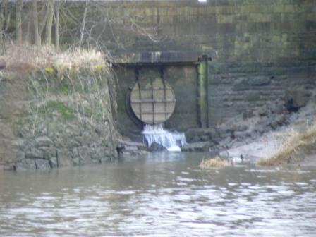
Penwortham has been inhabited since 4000BC. The Riversway Dockfinds, a collection of animal bones, 30 human skulls, two dug out canoes and the remains of a timber structure suggest the existence of a lake village on Penwortham Marsh. Nearby is Castle Hill, a point of military and religious importance. There is a church dedicated to St Mary on the summit of Castle Hill, which means it was likely to have been a pre-Christian sacred site.

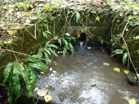
That the church is dedicated to St Mary and she was also the patron saint of a healing well at the foot of Castle Hill suggest the presence of an earlier female deity with healing powers, who has been Christianised as Mary. Three human skulls found in the wall of the church (17), which may have served an apotraic function suggest superstitious beliefs in chthonic spirits were also once popular but not openly acknowledged.

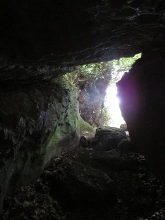
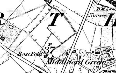
The survival of the legend of Penwortham Fairy Funeral attests to these superstitions. In the earliest version in Bowker’s Goblin Tales of Lancashire (1878), it is set on Church Avenue on Castle Hill. Two men walking home to Longton encounter a procession of fairies carrying a coffin. Robin, one of the men, looks into the coffin and sees his own miniature corpse. Frightened by the sight, they follow the fairies into St Mary’s graveyard. Robin attempts to prevent the burial by reaching out to grab the leader of the fairies. The procession vanishes and Robin, driven mad, topples to his death from a haystack a couple of months later (18). In later versions, this story takes place on Fairy Lane, which runs through Penwortham Wood at the foot of Castle Hill.

This legend may be interpreted to hint at older beliefs in underworld gods. Church ways are often identified with spirit paths. It is possible that prior to Christianity people believed chthonic spirits to have been actively involved in bearing the deceased to the underworld. The ringing of bells to drive them away and superstitions surrounding lych gates are testaments to fear of such entities. The movement of the legend to Fairy Lane may be seen as an attempt to sever their connection with the church. It is also possible it represents a shift in the energy of the area.

Gwyn ap Nudd and the spirits of Annwn (more frequently referred to as fairies today) are frightening beings. However, they play an essential role in maintaining the relationships between the worlds, the seasons, and the living and the dead. Like death itself and the cold dark of winter they will never go away. Their roles and identities, covered over or ignored for many centuries, can be recovered and understood.

Like Pwyll’s meeting with Arawn, my relationship with Gwyn has changed my life. He guides me to visions in Annwn and the physical world I would not be able to access without him. He teaches me to walk the spirit paths and inspires me to learn the song lines of this land’s ancestral heritage.

As late summer arrives, harvesters take to the fields and leaves begin to fall I sense the spirits of Annwn stirring, the first hint of the breath of winter on the wind. Monday is the date of the commemoration of the beginning of the First World War. When I help lay candles in front of Preston cenotaph for each of the 1956 soldiers who lost their lives I will remember that care of the souls of the battle dead was once believed to be Gwyn’s role.

(1) http://www.caerfeddwyd.co.uk/
(2) http://www.mabinogi.net/sections/Appendix/The_Underworld_Gods.pdf
(3) James MacKilliop, Dictionary of Celtic Mythology, (1998), p375
(4) Robin Herne, Old Gods, New Druids, (2009), p48
(5) A collection of Kingdoms in the North of England and Southern Scotland from 500AD and 800AD.
(6) Transl. William F. Skene, ‘The Dialogue of Gwyddno Garanhir and Gwyn ap Nudd,’ The Four Ancient Books of Wales, (2007), p210-211
(7) Transl. Sioned Davies, ‘How Culhwch Won Olwen,’ The Mabinogion, (2007), p199
(8) Ed. Rachel Bromwich and Simon Evans, Culhwch and Olwen, (1992), p169
(9) Transl. Sioned Davies, ‘How Culhwch Won Olwen,’ The Mabinogion, (2007), p199
(10) https://www.blogger.com/profile/02055792516386371373
(11) Ed. Rachel Bromwich and Simon Evans, Culhwch and Olwen, (1992), p133
(12) Ibid. p150
(13) Elen Sentier, Elen of the Ways, (2013), p26-28
(14) Dafydd ap Gwilim, Poems, (1982), p132 – 133
(15) http://www.maryjones.us/ctexts/collen.html
(16) Francis Thompson, The Hound of Heaven and Other Poems, (2000), p11
(17) Rev C. Nelson, St Mary’s Church, Penwortham, Lancashire, Archaeological Watching Brief and Explanation, (2011), p48
(18) http://www.gutenberg.org/files/39712/39712-h/39712-h.htm#THE_FAIRY_FUNERAL

Many thanks to Heron and Lee at Caer Feddwyd for bringing Will Parker’s article to my attention.

Ribble Illusions

Yesterday I had a most uncanny experience. Approaching the river Ribble from Castle Hill, I found myself facing a long stretch of tide marked wall that gave the appearance it had dropped away into nowhere. I was struck by a sudden sense of vertigo. The Ribble couldn’t have disappeared, as if had fallen into a void, surely?

River RibbleOn closer inspection, seeing the reflections of the grilles and staircases, and catching subtle fluctuations in the surface of the water, I realised this was an illusion created by a combination of its stillness with the markings on the stone.

River Ribble, reflection of a grilleRiver Ribble, stairsTo my relief at either end of the concrete barriers, the ‘true’ water level was clear.

River Ribble, water level

River Ribble, water levelDrawn  to stay a while in meditation on the strange appearance and disappearance of the river, which occurred as I shifted my eye-line, I was gifted with the sight of several birds. Common and black headed gulls and terns circled, their darker shadows mirrored in the water. Another bird, which I think may have been a grebe or even a black throated diver flew in. Diving with quick flips of its tail it emerged, for the most part, triumphant with white-silver fish, which after a brief kerfuffle vanished down its throat. Finally, a heron arrived to land majestically on a piece of flotsam.

Heron, river RibbleFor me this goes to show that even where it is channelled, the Ribble is a magical and mind altering place. I give thanks to the river, all its visitors and inhabitants, and its goddess Belisama.

Fish House Brook

Fish House BrookFish House Brook is a stream in Penwortham, which runs from behind my street, Bank Parade, through Greencroft Valley to the river Ribble. Since I started litter picking in the valley three years ago I have been clearing the brook, walking it regularly and researching its history. This article traces its course from source to mouth and provides snap shots of the ways people have related to it over the last few centuries.

~

The source of Fish House Brook and its earliest stretch have been culverted underground. Its course is indicated by the street names Bank Parade and an adjacent cul-de-sac called Burnside Way. It runs underneath the gardens on the eastern side of Bank Parade.

Bank Parade and Burnside Way, courtesy of Mario Maps

Bank Parade and Burnside Way, courtesy of Mario Maps

A few months ago Gordon at number 14 kindly invited me into his garden to see the site of its steep banking, which is now occupied by a pond.

FHB tributary's old valley BP no. 14 - CopyHe also lifted the grille to let me take a peek at the swiftly flowing underground stream.

FHB culverted tributary - CopyThe brook now emerges from a concrete pipeline behind Malt Kiln Cottage.

Fish House Brook, sourceThe following maps show Fish House Brook running from behind Malt Kiln Cottage into Greencroft Valley in the 1840’s and today.

Malt Kiln Farm and Greencroft Valley

Malt Kilm Cottage and Greencroft Valley 1840’s, courtesy of Mario Maps

Malt Kiln Farm and Greencroft Valley

Malt Kiln Cottage and Greencroft Valley now, courtesy of Mario Maps

Malt Kiln Cottage

Malt Kiln Cottage

Malt Kiln Cottage originally housed a water mill used to mill grain for beer. A picture of the pool behind the mill leat can be found on the Tithe Map (1838). Elizabeth Basquill provides a detailed account of how the malsters in residence used water from the stream and adjacent well to soak barley in a malster’s trough before it was dried and delivered by horse and cart round the corner to the Black Bull pub (2).

Malt Kiln Cottage, Tithe Map, 1838

Malt Kiln Cottage, Tithe Map, 1838

During this period Fish House Brook must have been much larger and more powerful to turn a water wheel. Its diminishment shows the effect of building 300 houses and their accompanying pipelines for clean water, drainage and sewage during the Central New Towns Project in the 1980’s.

Greencroft Valley

Greencroft Valley

Greencroft Valley is the largest surviving green space between the new estates. The old field lines remain intact, indicated by rows of trees. The wooded areas provide living space and nesting places for hedgehogs, squirrels and birds including magpies, wrens, a variety of tits, nut hatches and a woodpecker.

Greencroft Valley

Greencroft Valley playing field

The brook has had its share of pollution problems, mainly from grey water out of faulty washing machines. Since reporting this, it has been less frequent. Frog spawn and frogs have been seen, and a few smaller insects. However, there is no sign of any fish. This is disappointing as the 1840’s map shows a fish pond, which according to the Tithe Map was in Fish Pan Field, suggesting local people used to pan in the brook for fish.

Fish Pan Field

Fish Pond and Greencroft Valley 1840, courtesy of Mario Maps

Fish Pan Field

Greencroft Valley now, courtesy of Mario Maps

The brook is culverted from Greencroft Valley beneath Hill Road South.

Fish House Brook, Culvert under Hill Rd SouthIt emerges close to Rosefold house and cottages.

Rose Fold Cottages

Rose Fold Cottages

According to Elizabeth Basquill the cottages and yard were part of a tannery. During the late 19th century Fish House Brook was used to wash hides. ‘The hides were soaked in slaked lime first, then washed, and the hair and flesh scraped off.’ This process would have caused considerable pollution to the stream. Two adjacent fish ponds, which Elizabeth believes may have existed from the medieval period were ‘later used as tan pits for washing the skins’ (3).

Rosefold

Rose Fold 1840, Courtesy of Mario Maps

Rosefold

Rose Fold now, courtesy of Mario Maps

The first stretch of the brook, heading northeast, cannot be followed behind the houses. Where it makes a rightangle and heads northwest, a footpath runs alongside it. This follows the line of a much older route that led from Middleforth Green to St Mary’s Well (4).

Fish House BrookIt then bends right and passes through Campbell’s Park Homes following its old course round the back of the mobile houses.

Fish House Brook, Campbell's Park Homes

Fish House Brook, Campbell’s Park Homes

Campbells Park Homes, Meadows

Fish House Brook 1840, courtesy of Mario Maps

Campbell's Park Homes, Meadows

Fish House Brook, the Meadows and Campbells Park Homes now, courtesy of Mario Maps

The residential park nestles within the triangle of Penwortham Junction. The train lines pictured closed in 1965 and are now covered by beech, birch, sycamore, bramble and an array of wildflowers, forming important wildlife corridors.

Campbell's Park Homes

Campbell’s Park Homes

Another tributary enters Fish House Brook, running from the back of Far Field across the meadows. The pathway to St Mary’s Well crosses it, and there is a newer footbridge further south. At this time of year the meadows are thriving with mayflowers, buttercups, plantain, wild carrot, orange tipped and cabbage white butterflies and an abundance of bees.

The Meadows

The Meadows

The brook runs through Penwortham Allotments (unfortunately out of bounds) then is finally culverted beneath Leyland Road under Fish House Bridge.

Fish House Bridge

Fish House Bridge

Fish House Bridge

Fish House Brook culverted under Fish House Bridge

The 1840’s map shows a lodge beside Fish House Bridge. Alan Crosby says the bridge took its name from a timber building which ‘served as the quarters of the manorial river bailiff.’ This dwelling was adjacent to the fish garths, which were mainly used for catching salmon between December and August. It was the bailiff’s task to make sure the fishermen from different townships abided by the rules of the fisheries (5).

Fish House Bridge

Fish House Bridge 1840’s, courtesy of Mario Maps

Fish House Bridge

Fish House Bridge now, courtesy of Mario Maps

It is clear Fish House Brook derives its name from the Fish House, and as far as I know, no trace of an earlier name remains.

~

Each of these locations holds a story and discloses a relationship between the brook and the people who have depended on it. Since water started being piped in the 19th century, we’ve had no need to fetch it from wells or streams for drinking or bathing. Due to modern farming and production methods few of us rely on local waterways for fish, mill our own grain or tan our own skins.

This has a distancing effect. Due to continuing building work, I cannot imagine a time when the water from Fish House Brook will be safe to drink. It is uncertain whether fish will return, although some small fish were sighted by mum in nearby Penwortham Brook.

Small fish photographed by my mum in Penwortham Brook. Can you identify them?

Small fish photographed by my mum in Penwortham Brook. Can you identify them?

Whilst it’s impossible to turn back the clocks, I think there is time to get to know and understand our watercourses, and the lives and motivations of the people who have worked with and changed them. This article is an early marker stone on the journey through this process for me.

(1) Courtesy of Mario Maps
(2) Elizabeth Basquill, More Hidden Histories of Penwortham Houses (2011), p6-11, 42-44
(3) Ibid, p34-36
(4) St Mary’s Well was famous for being the cleanest source of water in the area and was attributed healing properties. Local people used to walk a mile to access their favoured water source, and it was also a site of pilgrimage.
(5) Alan Crosby, Penwortham in the Past, (1988), p48

Black Dog

He lies beneath my bed
and skrikes through the night,
plummeting the suburb into blackness.

Dampening floodlit windows,
putting out the streetlights,
he licks my hand when I am lonely.

When I fear I cannot live he takes me
to the otherside where we enter
the secret commonwealth of Middleforth

padding along the causey past the windmill’s
constant throb, cows with swaying udders
and hens clucking in the tithe barn.

Yet on communal ground
we are still invisible outcasts
with insatiable hunger and baleful breath.

Bound here by an obscure debt we pace the causey,
sniffing for dog-bones buried by the wayside
in a ritual that once had meaning on a lightless night.

Middleforth BrowMiddleforth Green, Spring Mist 007 - CopyMiddleforth Green